Description
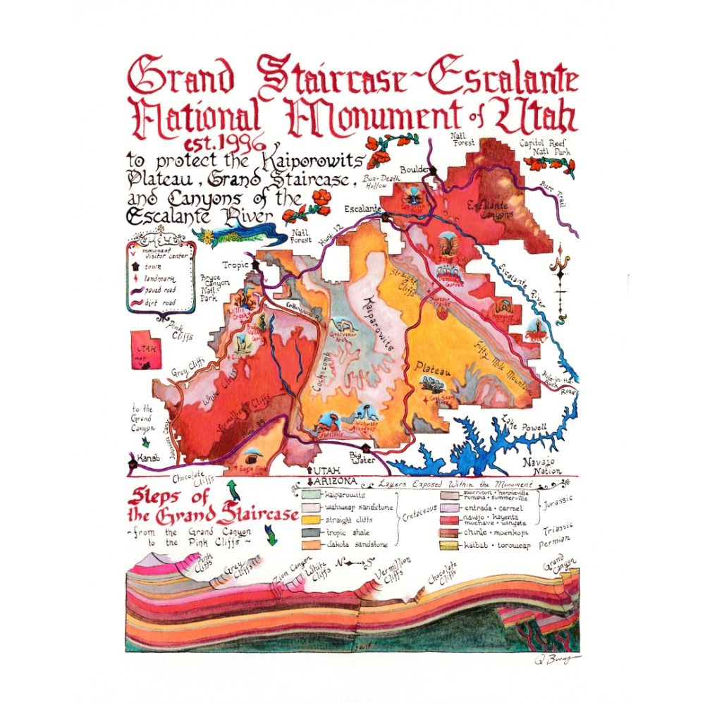
The bottom diagram shows the geologic layers of the Grand Staircase. The map shows how those layers climb and branch across the land. Landmarks are illustrated in miniature. Hand-lettered and hand-painted in the vibrant colors of the desert.
Available in 2 sizes:
- 11×14 on smooth, durable vinyl poster paper
- 16×20 giant map on cold-pressed watercolor paper – the texture makes the prints look like originals!
This map features the original boundaries of the Grand Staircase as it was designated in 1991. As of July 2026, President Trump (probably illegally) shrank the Grand Staircase-Escalante National Monument to 90% of its original size. This place is very dear to us, and the reduced boundaries leave millions of acres vulnerable to extractive industries. We will be donating a portion of sales of our Escalante National Monument maps and cards to Utah organizations who are fighting this executive order and standing up for public lands.







Reviews
There are no reviews yet.